
On this page:
Keeping satellite observations accurate
Radar satellites provide valuable information for environmental monitoring, resource exploration and disaster response. But to ensure satellite images accurately align with locations on Earth, satellite systems need reliable reference points on the ground.
In 2014, the Queensland Corner Reflector Array was installed across Queensland’s Darling Downs region as part of the Australian Geophysical Observing System. Supported by a $1 million investment from AuScope through the Australian Government’s National Collaborative Research Infrastructure Strategy (NCRIS), the array formed part of AuScope’s national geodetic research infrastructure, now supported through its Geodesy and Geodynamics Program.
More than a decade later, this infrastructure has become an internationally significant asset for Earth observation.
Simple infrastructure supporting sophisticated satellites
The array consists of 40 radar corner reflectors spread across an area approximately 130 by 130 kilometres. The triangular aluminium structures require no power and do not collect or transmit data. Instead, they act like highly visible mirrors for radar signals sent from satellites orbiting Earth.
Because the precise position of each reflector is known, space agencies can use them to calibrate and validate Synthetic Aperture Radar satellite systems, helping ensure satellite observations are accurate and reliable.
The scale and configuration of the Queensland array make it unique internationally.
From Queensland paddocks to global space missions
Today, more than 15 international space agencies and commercial space companies use the Australian infrastructure to support satellite calibration, including the European Space Agency, Japanese Aerospace Exploration Agency and NASA.
The European Space Agency regularly uses the array to calibrate its Sentinel 1 satellites. Data from Sentinel 1 supports applications around the world, including environmental monitoring and disaster response.
Geoscience Australia is also working to embed the Queensland Corner Reflector Array within SARCalNet, a global network of calibration infrastructure supporting current and future radar satellite missions.
An investment that continues to deliver
For Australians, the Queensland Corner Reflector Array demonstrates how investment in national research infrastructure can create benefits far beyond its original purpose.
Infrastructure initially established to support Australian geoscience is now contributing to the accuracy and reliability of satellite observations used internationally. Reliable Earth observation data supports our ability to monitor environmental change, understand natural hazards, manage resources and respond to disasters.
AuScope’s early investment helped establish a capability that other organisations and international agencies have continued to build upon. More than ten years later, the infrastructure remains operational and is supporting some of the world’s leading space agencies.
The Queensland Corner Reflector Array demonstrates the long-term value of NCRIS investment: relatively simple infrastructure established to address an Australian research challenge has evolved into a globally significant asset supporting trusted Earth observation data and strengthening Australia’s contribution to international space and Earth science.
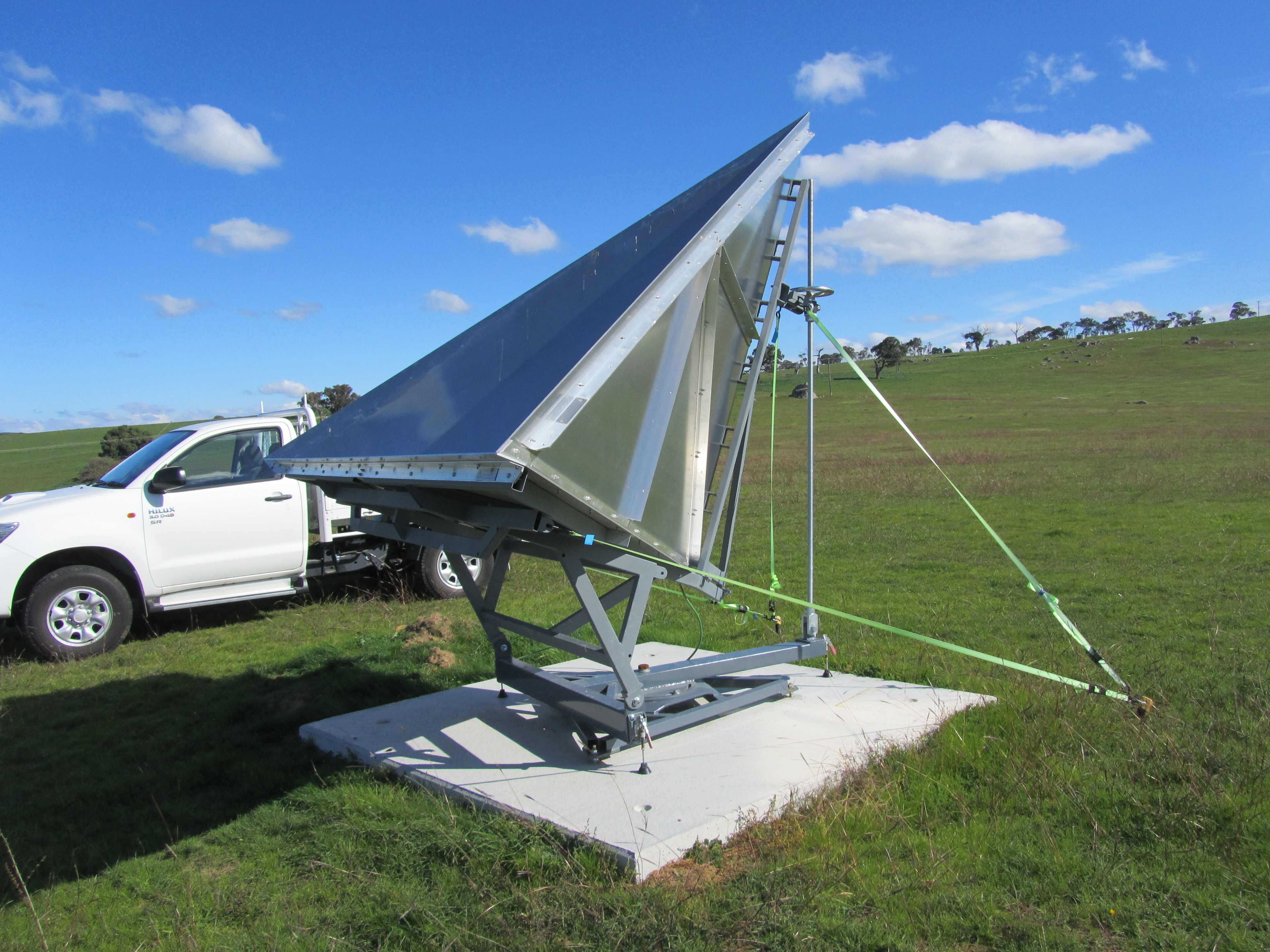
An InSAR corner reflector in Queensland, part of the Queensland Corner Reflector Array used to calibrate and validate satellite radar observations.
Credit: Dr John Dawson, Geoscience Australia
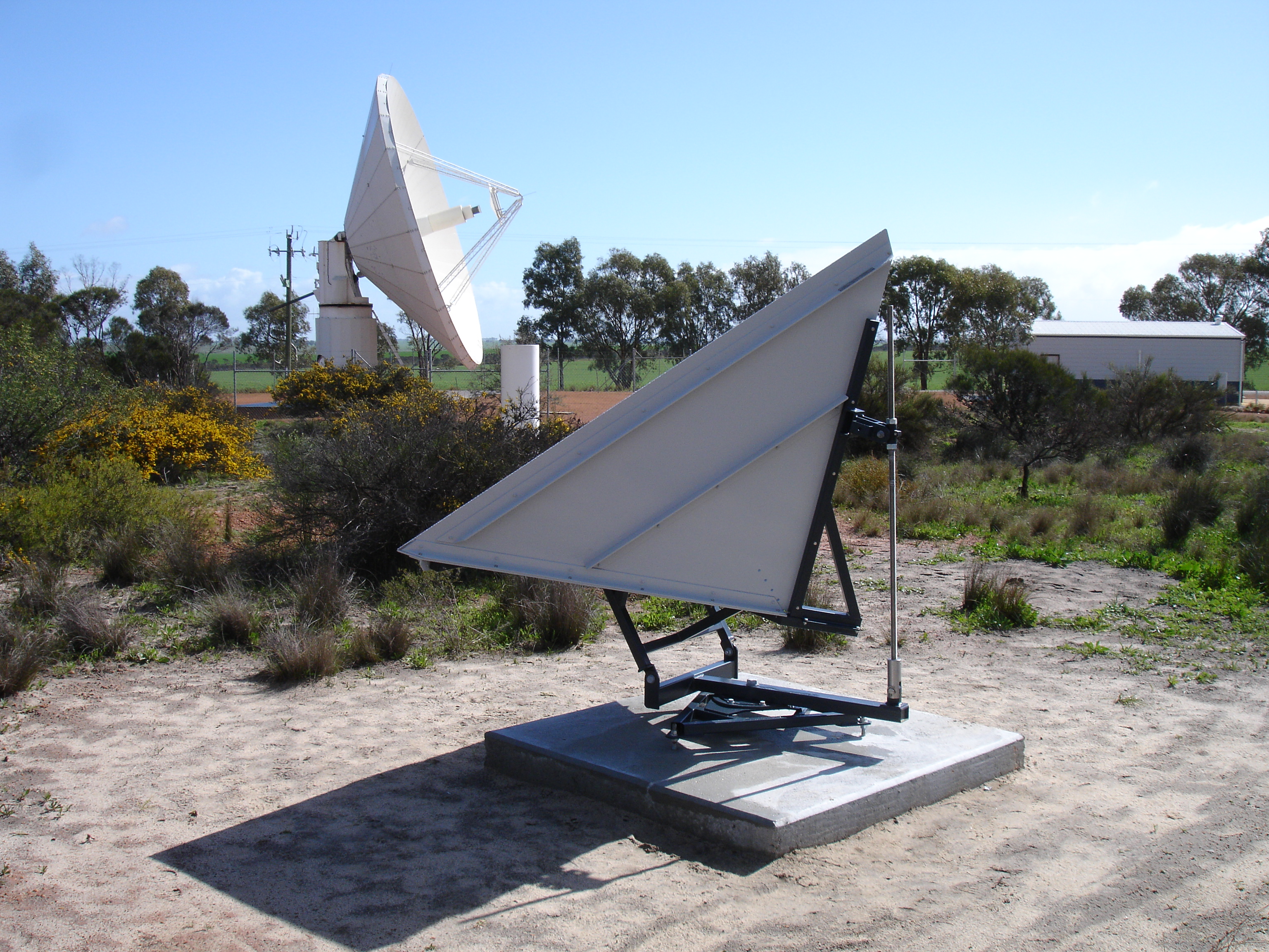
An InSAR corner reflector at Geoscience Australia’s Yarragadee Observatory in Western Australia. Corner reflectors provide precisely located reference points that support the calibration and validation of satellite radar systems.
Credit: Dr John Dawson, Geoscience Australia