
Research led by Dr Antonia Settle examined how the financial impacts of flooding were distributed across communities in the Northern Rivers region of New South Wales.
On this page:
By combining detailed flood mapping with socioeconomic and property-market data, the research revealed significant differences in how communities experienced the aftermath of flooding. Poorer inland communities showed stronger patterns of distress sales and property price declines of up to 27 per cent. The greatest impacts became apparent around 18 months after the flood.
These findings show that the financial effects of a natural disaster can continue well beyond the immediate emergency response and can affect communities very differently.
AURIN provided access to Australian Property Monitor data through the AURIN Data Provider, enabling researchers to integrate detailed property information with flood and socioeconomic data at a fine geographic scale.
Supporting more targeted disaster planning and recovery
The research provides evidence that can help governments and communities understand where the longer-term economic impacts of disasters are likely to be greatest.
Identifying when and where property markets experience distress can inform the timing and targeting of recovery programs, financial assistance and other government interventions. It can also contribute to longer-term planning for climate adaptation by showing how existing socioeconomic disadvantage can compound the effects of natural hazards.
As climate change increases exposure to flooding and other extreme events, this type of evidence can help ensure disaster planning considers both physical risk and the capacity of communities to recover.
Why investment in research infrastructure matters
Understanding disaster impacts requires information from many different sources, including environmental, demographic, economic and property data.
AURIN provides researchers with access to datasets and infrastructure that allow these different forms of evidence to be brought together and analysed spatially. For this project, access to detailed property data helped reveal economic impacts that may not have been visible through flood mapping alone.
Investment in research infrastructure makes this type of integrated analysis possible, helping researchers produce evidence that can support fairer disaster recovery, stronger climate adaptation and better targeted government policy.
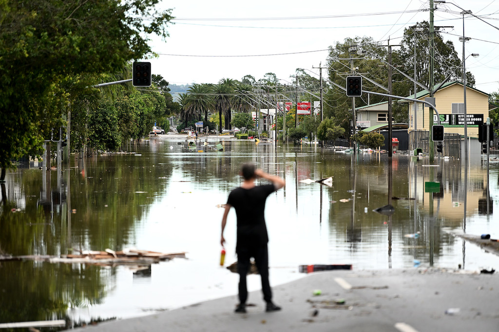
Person looks down flooded main street of town.
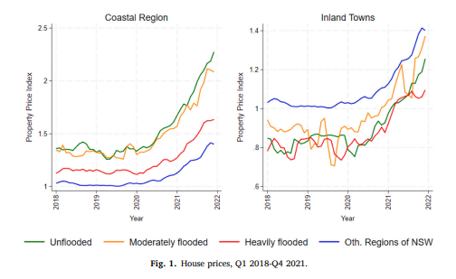
Line graph showing house price trends from 2018 to 2021 in coastal and inland NSW regions, comparing unflooded, moderately flooded, heavily flooded and other areas. House prices generally increased across all regions over the period.